Communities in Transition
With the aggressive construction and development of New Clark City comes massive changes for the communities in its bounds. These changes come in different forms: physical and environmental changes, shifts in livelihood, and social and cultural transformations.
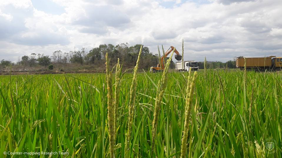
Big machines stand out amidst the golds and greens of lush rice paddies.
Despite branding New Clark City as a ‘green city’, BCDA has scraped off most of the ‘greens’ in favor of building this ‘smart’ city. Upon arriving in the study area, what should have been lush, green paddies in an agricultural community have been bulldozed and declared off-limits, prohibiting further agricultural cultivation. Dusty roads and infrastructures now stand in contrast with what used to be vast agricultural lands developed by generations of settlers. Families have reported that aside from their rice fields, their hills and mountainsides have also been excavated to serve as fillers for road projects in within New Clark City.
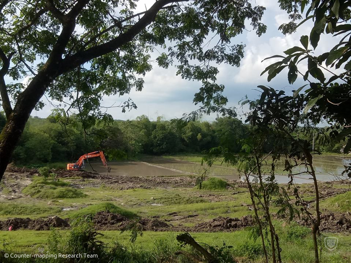
Rice fields are being excavated regardless of its productivity, drastically changing the physical landscape and forcing farmers and their dependents to seek employment elsewhere.
New Clark City not only changed the communities’ landscape, it also affected the bodies of water in the surrounding areas. Sapang Kawayan (Bamboo Lake), which is not only crucial for rice field irrigation but also a source of food, was re-routed to serve as a supposed contingent catch basin for flood waters. This resulted to irrigation being cut off. It also produced murky, polluted waters and the decline in the number of fishes and crustaceans in the area. Flowing water bodies such as those situated along the path to Mount Dalin have also been cut off and made stagnant after countless excavations.

A mountain was excavated to make way for the development of infrastructure in the proposed New Clark City. This part of a mountain would serve as fillers that would cover what would once was rice fields.
Further up Mount Dalin, one can see rich fruit orchards, houses, and community buildings demolished. Fruit-bearing and non-bearing trees alike have been cut and uprooted to make way for the infrastructure projects lined up for the ‘green city’.
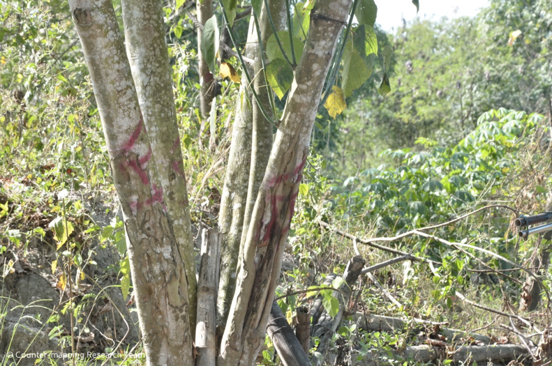
Trees of value have been marked with red paint. Should the farmer decide to sell his rights to the land, he could opt to either sell his land or valuate their property based on the sum of the prices of the trees planted on his land.
Trees that haven’t been cut are counted and marked with red paints indicating that once farmers decided to sell their land, they could opt to receive an amount equivalent to their land area or their trees.

Machines and trucks in Sitio Alli have already flattened homes, hectares of orchard gardens, and even a community church.
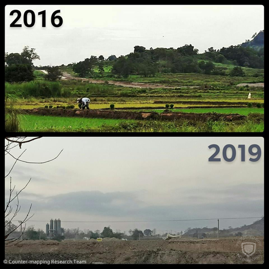
Where the communities' centuries old trees and fruit-bearing mango trees once stood has now been turned into a complex where amenities for South East Asian Games will rise. Further changes in the community are depicted in this photo taken three years apart.
Land owners have also abandoned their houses nearby the flattened areas and have decided to move elsewhere. These, along with the fields on the lowlands, are where infrastructures such as roads and administrative buildings are rising. These lands where locals used to roam freely are now demarcated and restricted. Mojons or stone markers have also sprung up around the community bearing either the CGC [Clark Green City, New Clark City’s name prior] or NCC sigil, affirming that their land and sitios would further be damaged by New Clark City.
With these changes in the physical environment comes the changes in the people’s daily activities. Farmers who used to till the lands were forced to seek employment elsewhere lest their families starve. Most able-bodied residents opted to work as construction workers temporarily while others have turned to driving tricycles and other odd jobs to make ends meet. Some of the older farmers who lost their livelihood had opted to turn to jueteng, an illegal number game, to earn their keep.

Some residents who were dependent on the land for employment has turned to tricycle driving to earn income. However, this occupation is temporary at best as there are talks of overhauling every other form of transport within New Clark City in favor of self-driving cars.
Houses and apartments for rents have also sprung up in the densely populated parts of the community catering to the rising influx of outsiders who relocated to work as construction workers. Locals whose houses were bulldozed also opted to rent nearby spaces in hopes that the BCDA would eventually relocate and compensate them. Likewise, homemakers of the displaced families resolved to help earn money by setting up small eateries and food stalls catering to the construction workers.
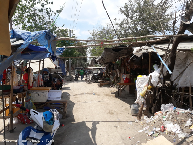
Former tillers of the land have taken to finding alternative ways to earn income. Homemakers of the houses that once stood within and near the boundaries of construction sites now sell snacks and lunches to workers to support their families.
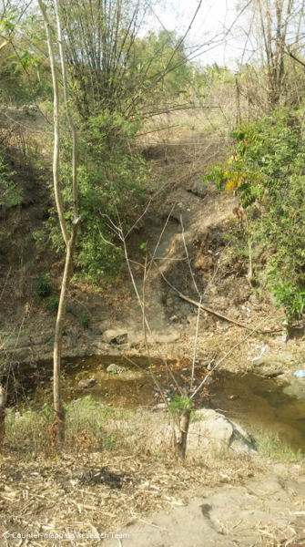
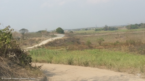
As opposed to the demanding path towards Dapdap which includes multiple passage through streams and steep trails (left), the dusty road leading to Navy (right) made selling goods less tedious which is why residents of Sitio Kalangitan prefer to bring their goods to Navy rather than Dapdap.
Indigenous people living in Sitio Kalangitan are being forced to change their lifeways. They usually bring their foraged goods in the markets of Dapdap and Navy for selling. However, fewer residents are trekking the path to Dapdap after a dirt road path was carved into their mountain. Residents cited that it saves them time and energy to just bring their goods to Navy rather than cross streams just to get to Dapdap.